Mexico's Volcanoes 2008

Climbing the main volcanoes in Mexico during the year 2008: Iztaccihuatl, La Malinche, Nevado de Toluca, and Sierra Negra
Idioma/Language: English Español - Visita también: Volcanes de México 2009 - Volcanes de México 2010

Climbing the main volcanoes in Mexico during the year 2008: Iztaccihuatl, La Malinche, Nevado de Toluca, and Sierra Negra
The Pico de Orizaba, or Citlaltépetl (from Nahuatl citlal(in) = star, and tepētl = mountain), is a stratovolcano, the highest mountain in Mexico and the third highest in North America. It rises 5,636 meters (18,490 feet) above sea level in the eastern end of the Eje Volcánico Transversal mountain range, on the border between the states of Veracruz and Puebla.
Source: Pico de Orizaba, Wikipedia
The Pico de Orizaba at 5,610 m is the highest elevation of Mexico and the third highest mountain in North America, only exceeded by Mount McKinley (Denali) in Alaska (USA) with 6,194 m, and Mount Logan in the Yukon Territory (Canada) with 5,959 m.
The Pico de Orizaba is ranked 7th in the world in topographic prominence and 16th in the world for topographic isolation.
The Pico de Orizaba is located very close to the Sierra Negra volcano, as we can see in the following picture, where Sierra Negra is situated to the left and the Pico de Orizaba to the right:

The approach to the Pico de Orizaba is a bit complicated, since it is quite isolated. If you don't want to approach on foot, you can hire a four-wheel drive transport. Fortunately, the Pico de Orizaba can be climbed by any of its slopes.
The normal route of climbing is via the north face through the glacier Jamapa. The mountain hut Piedra Grande (4,250 m) is often used as a starting point, which can be reached from the west from Tlachichuca, and from the east from Coscomatepec.
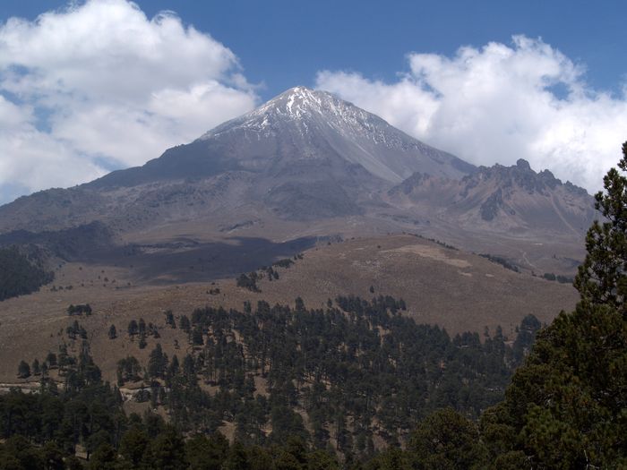
The southern route is one of the easiest routes. This route often uses Fausto González Gomar mountain hut (4,660 m) as a starting point, and the climb to the summit usually lasts 5 to 7 hours. In the next picture, taken from near Sierra Negra, the south face of the Pico de Orizaba can be seen:

More information: